|
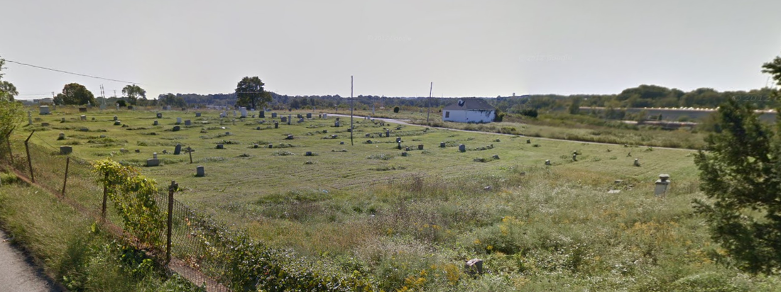
It was already 11:45 when I threw my leg over my bike and pedaled out of my neighborhood. The morning warmth was swiftly being overtaken by noontime heat. A quarter mile from home, I swung into the local bike shop and asked them to quickly "fix" my front derailleur: it wouldn't shift to the small ring, and the thought of 30 miles of unknown terrain without that option, especially on a day like this, did not appeal. Repair done, I was truly on my way. The ride to the Washington & Old Dominion Trail is relatively easy, and once there, it's a pretty straight shot into D.C. I sipped at my water every mile or so, well aware that the sun would bake out whatever fluids I had. Surely, though, there would be ample opportunities to pick up more on the way. Heading down a bombing hill into Arlington, I had my first scare. A car crossed the intersection in front of me (as it should have), but I soft-pulled the brakes; as the car slowed to keep from bottoming out, I realized I was about to T-bone it, and I pulled the brakes hard enough to pop the rear wheel off the ground briefly to keep from entering the roadway. It was a brief mental lapse, but it would not be my only close call of the day. I normally hit D.C. early in the morning, when there are few or no pedestrians and it's easy to cruise across the monument/Mall area without taking on traffic. At shortly after noon on a Saturday, that's most assuredly not the case. I was surprised to find that the Lincoln Memorial crowd was relatively light, but by the time I reached Constitution Ave, it was clear there would be no riding on the broad sidewalks heading to the Washington Monument and, ultimately, the Capitol Building. I hopped onto Constitution and rode with traffic for several blocks, occasionally dodging around a double-parked car, a mysteriously stopped tour bus, or a frustrated Metro bus that couldn't make a sharp turn. At 15th St, I decided to head uptown instead of staying in this mass of stress, and booked it up to M St., which eventually enters the Metropolitan Branch Trail. East on M, I had an actual near-miss, one that set me on edge and caused a couple pedestrians to wonder what they just witnessed. An out-of-town SUV trickled its way down the road, the driver clearly confused about where he was. Finally, he slowed, put on the right turn signal, and moved to the right, at which point I pulled left to pass. And was shocked to find that the signal and evident move was just a prelude to a U-turn -- a U-turn where the driver didn't even seem to understand that he did something potentially deadly. I yelled (as one does) at the driver, but he was so firmly ensconced in his vehicle shell that I doubt he even knew I was there. Just a few blocks to go, though, and I'd be at the trail; I tried to put the incident behind me. A couple blocks from the trail entrance, a set of pylons demarcates the road and bike lane. At the trail entrance, the cones give way to a broad crosswalk, and the curb gives way to a wide cut with almost no rise. Unfortunately, that loss of cones was also apparently the signal to an adjacent driver that they could just pull right over, which is exactly what a complete git from New York did. I was close enough to punch the car and was saved only by the width of the cut, which I was able to veer into without incident. At that point, I hated D.C. I hated the out-of-town drivers confused about where they were and what they were doing, who were fully separated from the world outside to the extent that they very easily could take out a pedestrian or cyclist and probably wouldn't notice. I wasn't through the city yet, but I'd traversed the most dangerous part, and I hoped the rest of the ride would be relatively safe. The Metropolitan Branch Trail is an easy section to ride on, its several miles paralleling the train tracks heading north-by-northeast. It dumps a rider just outside of Mount Rainier, an old-style and quite cute little neighborhood that obviously doesn't get much love in terms of infrastructure. The busy through streets are narrow and poorly-organized, then dive into the valley where the roads are extremely wide but ill-maintained, full ribs of blacktop pressed up by underground roots along much of its length and unrepaired potholes littering the interregnums. The street part of this segment ends at the Northeast Branch Trail, a part of the Anacostia Tributary Trail that takes the rider along the shockingly-named Northeast Branch Anacostia River. Past the College Park Airport -- the first airport I would cruise by that day, but definitely not the last -- the trail deposits users at Lake Artemesia, a park in Greenbelt, Maryland. At this point, I had nearly run out of water in my bottle, and at the north end of Lake Artemesia, I pulled to the roadside to drink the remainder of the water and refill the bottle with Vitamin Water. I took a few drinks from my newly-filled bottle and discarded the Vitamin Water bottle, as I could barely fit it in my back pocket and didn't feel like dealing with it in the future. This, I would find, was a mistake. I cut through the Dunkin' Donuts parking lot and hopped onto Cherrywood Ln, headed for Edmonston Rd and points north. Here's where Google Maps failed me in a way. I was told to stay on Edmonston up to Muirkirk, which was an acceptable route but clearly not the shortest. At Muirkirk, I turned right -- now heading straight east -- and busted a left on Cedarbrook Ln, which terminates at Montpelier Dr. Montpelier crosses the large Laurel-Bowie Rd and becomes Brock Bridge Rd, which swings pleasantly into a shaded area. At this point, the temperature was close to 90, and I was running out of my beverage. No problem, I thought. Surely there will be opportunities to refill in the next few miles. Passing Suburban Airport -- just over 2300 feet long with over 800 feet of displaced threshold -- I hoped to see a plane or two taking off. Alas, it was not to be, and, knowing what I did about the sections to come, I wasn't happy to see it slip behind. Brock Bridge slides through a small residential area, then heads past the Laurel Racetrack, where I was briefly reunited with hope for humankind when a driver trying to make a low-visibility turn onto Brock Bridge actually waved at me when she saw me, letting me know that she was fully aware I was there and that she wasn't going to run me over. I appreciated the gesture much more than I would have prior to the D.C. Death Dodge. As Brock Bridge moves north, it goes from shaded and cool to warm, open pastureland, then bends its way along the train tracks. At Dorsey Run, I turned north and passed the last convenience store I would see in quite a while. I did not stop, because I still had a quarter of a water bottle left and felt fine. I descended to a stop light and threw my chain. At a wide open island in the middle of a parking lot worth of blacktop, I pushed the chain back on, wiped my grease-covered fingers on my pants, and checked the map for my next couple turns. I hopped back on to cross with the light. My chain threw the other way, and I cursed loudly enough to get a chuckle out of a waiting driver. I was, to say the least, less amused. I put the chain back on and resumed course: north on Dorsey Run, through the hottest, most industrial part of the ride. Trucks passed at distressing distances, and as I sipped the last of my Vitamin Water, I looked around for a place to refill. There were none to be found. A mile passed. Then two. The heat had built into the low 90s. I was -- fortunately -- sweating. I was -- unfortunately -- also becoming tired. I heaved my way up rises and down their backsides, frustrated that this road in particular was more physically taxing than any I'd been on yet. At the turn onto Waterloo Rd/Jessup Rd, I spotted a Dunkin' Donuts at the entry point to what looked like a pocket of civilization. The DD was across the road and in a strip mall, a side-trip that didn't seem too inviting. I assumed that a convenience store would be in the offing, since a strip mall is rarely alone in the wilderness. Along Jessup, I was quickly disabused of this notion. Here, I made my first wrong move, going right by Wigley Rd because I was looking for Forest -- which turns out to be what that road becomes. I'm still confused about why this rinky-dink road needs two separate names, but I don't live in the area. I can only imagine there's some great, sub-surface battle waging over the name of Wigley. I quickly recognized the mistake and, on stopping to verify the route on my phone, I also mentally recorded the next half dozen roads. This part of the ride was becoming too strophic for a visitor to sort out readily. Indeed, one of the greatest challenges of the ride was simply figuring out the turns -- my normal "cue sheet" strategy can get upwards of 10 on a single sheet, but the current volume of road names would have overflowed that twice over. Back to the ride. Wigley, it turns out, also isn't forested -- it's open country that aligned perfectly with the 2 p.m. sun, giving me no relief from my thirst and tiredness. When Wigley gets to Forest, though, it becomes true to its name, and that small amount of shade was welcome. I spent a very brief moment on Dorsey Rd, then turned onto Coca Cola Dr, a name that does not appear to have any current affiliation with anything along its length. I turned onto Park Cir Dr (a name I find rather amusing, as it implies the circle but does not spell it out -- a suggestion that maybe it was intended to be "Park Circle" -- but also adds an abbreviated "Drive" like a useless appendage forged by some wayward development designer). At Race Rd, I made a left and was met with a "Road Closed Ahead" sign. I stopped and consulted the map. Yes, this was where I supposed to be. And Race Rd does go through. It also crosses a single waterway called Piny Run. I decided this sign was a good indication that I would not be threatened by any drivers in the near future, and plunged past the orange barrier, well aware that I may have to ford that stream. Had I not been so dehydrated, Race Rd would have been blissful. It dipped into a cool valley that was surrounded by shade, the discontent of heat and sun left behind on Coca Cola. About the only thing missing was, in fact, a drink. Well, that and a continuation in this state for the remainder of the trek. At the other end of Race Rd, I paused a moment to consult the map for the next few turns. It turns out I wasn't at the end of Race Rd, but rather at a small discontinuity. I re-found and continued along Race Rd to its actual end, then made another wrong turn on Furnace Rd, heading left (northwest) instead of right (southeast). Furnace Rd terminates at Rte 1, and Google was clearly not trying to take me there. But the one thing Google didn't know was that this terminus cohabitates with a convenience store. Alas, the store was not selling anything -- they were "temporarily closed" -- but fortunately they let me in to use the sink. I chugged about 40 oz of water and filled my water bottle. Feeling somewhat recharged, I turned around and went back along Furnace to River Rd, took that to Nursery Rd, and veered left on Hammonds Ferry Rd. I was still feeling good when I turned onto Hollins Ferry Rd, and I paused to check the map one last time at the top of a local rise. The neighborhood here was obviously financially downtrodden but still lively, and I was happy to duck into the shade for a minute. The rest of the route was now mentally manageable. Down Hollins Ferry about a mile is the Mount Auburn Cemetery, a locale I wish I'd stopped to photograph. This unique feature is an extremely old African-American cemetery, a broad swath of open greenery with scattered mid-19th century headstones, old wooden crosses, and a couple newer family stones. I've affixed a view of the cemetery from Waterview Ave, taken from Google Maps; I do not claim this photo, but find that the picture is rather enlightening as to what Mount Auburn offers. Waterview heads over Interstate 295 and ends at Annapolis Rd, at a light. Here, I found my strength waning and my desire to go on quickly fading. There were only a couple miles left, if that, but my legs were turning to jelly. I leaned my arms on my handlebars and stared at the pavement. These being the universal signs of exhaustion, a driver behind me at the red light yelled out his window, "Hey, bike guy, you going to be alright?" I looked back at him and smiled. "Only a couple miles to go. I'm sure I'll be fine." I was pretty sure I was right about that. Pretty sure. He yelled "good luck!" as he drove by on Annapolis, and I thought about how this was going to end. Annapolis ducks under Interstate 95, then casts off a small trail that wraps by the Greyhound station to the waterfront, coming back at the south end of the Ravens' stadium. I dodged around the stadium -- following signs to "downtown" -- and joined Russell St near Camden Yards. Russell branches off as Paca Ave in a smooth curve onto a one-way road northbound, with a light halfway through the curve. I slowed to a near-stop at this light, and as traffic pulled away, I thought about how close I was.
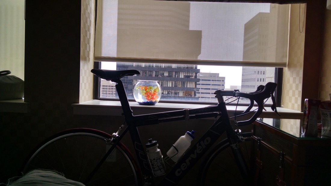
And that's when my chain threw: at the hardest point of my downstroke, at almost no speed, I simply fell over. I rolled my shoulder under and tried to smoothly end up near the sidewalk, but I failed to anticipate that I had my bike lock in the rear pockets. As I carried my bike to the side of the road and assured the driver behind me that I was fine, I cursed the front derailleur again. Perhaps, I thought, I should just walk the last quarter mile. But I'm a persistent bastard, and once the chain went back on, I rode up the sidewalk to the next intersection, hopped back into traffic, and made my way to the hotel to meet my family. When I got inside, I was seized with the desire to lie down. My back was sore from the fall, my legs and butt sore from the ride, everything else sore from the insane heat and lack of fluids. I was relieved and happy. I was frustrated and annoyed. I was all of these things, and ready to see and relax with people I love.
0 Comments
|
AuthorA beer-swilling cyclist. Archives
June 2015
Categories |


 RSS Feed
